
Leland ZIP Code Directory Coverage
Leland has one clearly primary postal geography and several nearby ZIP references that need careful wording. Census place evidence identifies 28451 and 28479 as fully or partly within Leland. County health-planning material also groups 28436, 28456, and 28422 with wider Northwest or Town Creek township service geography. That is useful context, but it is not a city-limit crosswalk. The correct question is whether a particular address is served by a ZIP or whether it lies in the town, not whether a broad ZIP label belongs wholly to Leland.
| ZIP code | Leland-related evidence | Post office information | Directory caution |
|---|---|---|---|
| 28451 | Primary Leland ZIP; Census ZCTA evidence and Leland Branch/Town Hall use | USPS Leland Post Office, 1123 Village Road NE | Delivery ZIP does not equal the town limit |
| 28479 | Census profile identifies it as fully or partly within Leland; also tied to the Town Creek and Winnabow side in county planning geography | Verify the serving station for an exact address | Do not label every 28479 address as inside Leland |
| 28436 | Appears with Belville, Leland, Navassa, and Sandy Creek in Northwest township geography | No Leland-wide post-office conclusion confirmed | Township service area is not a municipal boundary |
| 28456 | Also appears in the Northwest township/service grouping | May serve nearby county geography | No source proves every 28456 address is in town |
| 28422 | Appears in the Town Creek township grouping with 28451 and 28479 | Verify by complete address | Not a city-limit crosswalk |
The Leland post office at 1123 Village Road NE uses 28451 and publishes a 910-383-0922 contact number. Its retail hours in the research record are Monday through Friday, 8:30 to 4:30, and Saturday, 9 to noon. Those office details support the primary ZIP, while exact delivery service remains an address-level USPS question.
Leland ZIP Code Evidence Edges
The tempting shortcut is to treat a postal city label as a municipal answer. That shortcut fails along Leland’s edges. A parcel can have a Leland mailing city, a Brunswick County tax record, a nearby township or service designation, and a municipal layer that tells a different jurisdictional story. Postal Zones, Municipalities, precincts, school districts, fire districts, and flood layers are separate data sets. They should be compared, not merged into one claim.
Brunswick GIS lists postal zones that include 28422, 28436, 28451, 28456, and 28479 among many county ZIPs. The service lists are broader than the Census-place evidence. For a directory entry, say that 28451 is the primary Leland ZIP and that 28479 has partial Leland evidence. Describe 28422, 28436, and 28456 as nearby or township-related only when that is what the official source supports.
The Brunswick County maps and development dashboard hub provides the county’s map starting point.
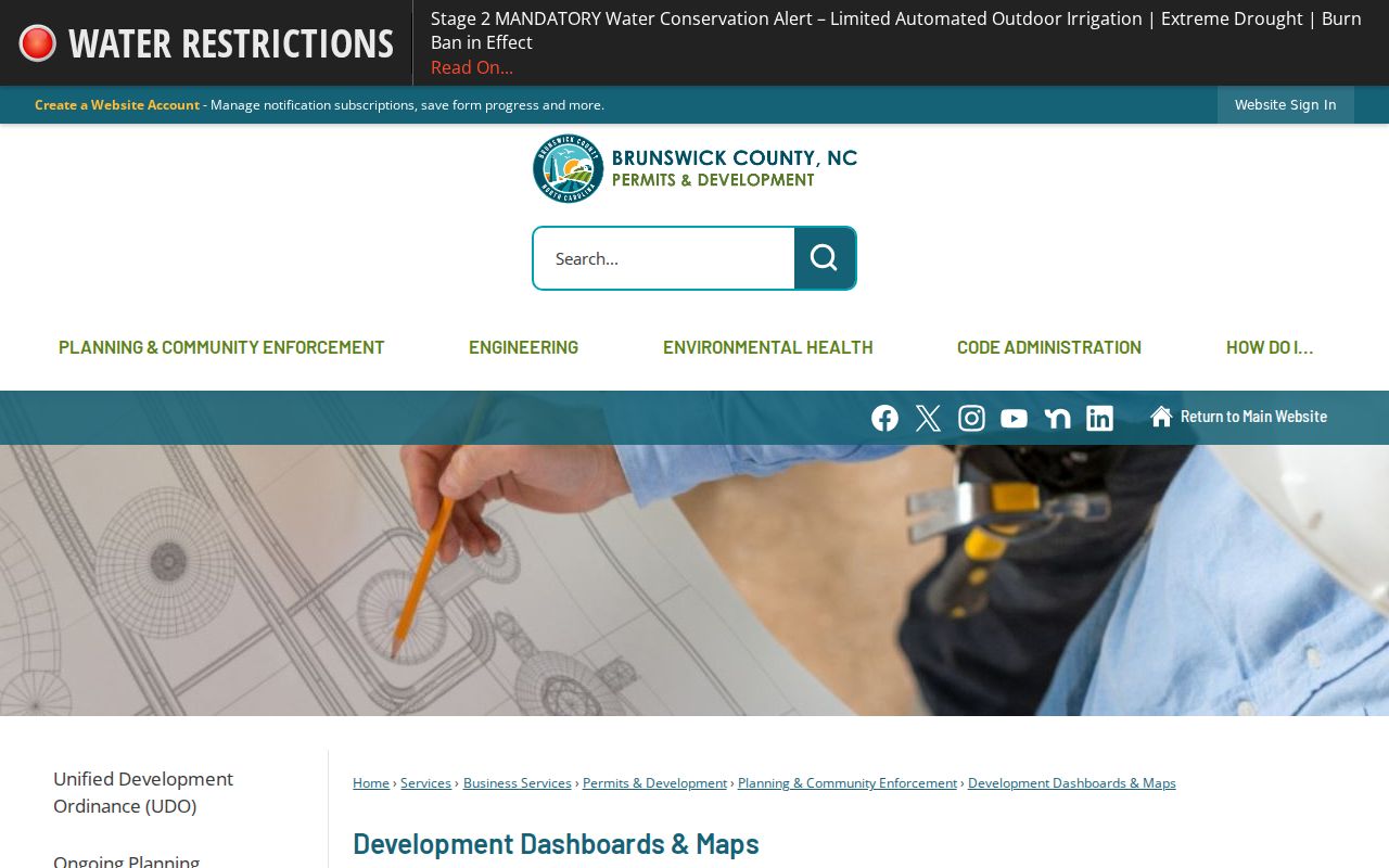
The county map resources help place a ZIP beside a parcel or municipality layer. They do not replace the final USPS address verification or establish a legal property boundary.
Note: A postal-zone result describes delivery geography, not proof of municipal jurisdiction or household identity.
Check a Leland ZIP Code
For a live delivery answer, use the USPS ZIP Code Lookup with the complete address. USPS is the final check for the delivery ZIP, city, and state associated with that address. It is more reliable than guessing from a neighborhood name or a nearby address. The research did not capture the individual on-screen USPS field labels, so no additional field names or filters should be assumed.
The public tools below have different search roles. The table distinguishes a confirmed field or layer from a field that the research could not verify. It does not turn a map overlay into a people search.
| Official tool | Confirmed input or layer | ZIP status and limit |
|---|---|---|
| USPS ZIP Lookup | Complete address, producing delivery ZIP, city, and state | Address-level check confirmed; individual input labels were not captured |
| Brunswick GIS viewer | Address or parcel search; Postal Zones and Municipalities layers | Map overlay confirmed; ZIP-wide resident query not confirmed |
| Brunswick tax/property portals | Owner, address, and parcel routes are advertised | Advanced ZIP field and ZIP-wide behavior are unconfirmed |
| North Carolina Voter Lookup | First name, last name, voter status; optional middle initial, birth year, and county | No public ZIP field or street-only mode |
| County permit reports | Downloadable and spatial-radius access around a parcel | ZIP column or filter was not verified |
The USPS address lookup is the official delivery check used at the end of a Leland ZIP code search.
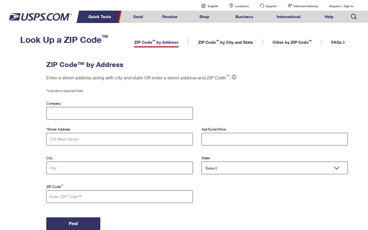
Use the USPS result beside, rather than instead of, the county parcel record. A valid delivery ZIP does not supply a legal description, property owner, municipal boundary, or complete address history.
Leland ZIP Code GIS Overlay
The Brunswick County GIS Data Viewer is the best way to compare layers around a specific address. Search the address or parcel, then turn on Postal Zones and Municipalities with the parcel layer. Add roads, address points, voter precincts, school, zoning, flood, or fire-district layers only when each answers a separate geographic question. The viewer is compiled from public deeds, plats, and related records, and is not a legal survey.
A parcel ID is often a stronger search key than exact address text. The county GIS help recommends it, and the sample format shown in the help is alphanumeric, such as 13900059. Use the portal’s displayed parcel ID rather than inventing a punctuation pattern. The parcel ID can bridge tax, map, and deed research even when a postal label or street wording changes.
For a ZIP question, the useful sequence is parcel first, postal zone second, and municipality layer third. That order makes an apparent mismatch visible. It also keeps the map from being mistaken for a directory of people. GIS can show the map context and owner pop-up where public; the tax card and recorded deed remain the sources for their own administrative and ownership facts.
Search a Leland ZIP Code
No confirmed official portal offers a public Leland ZIP-wide resident list. The county assessor’s ZIP field is unconfirmed, the state voter form has no ZIP filter, and the GIS viewer is an address-or-parcel map rather than a verified ZIP-wide people search. A sound workflow narrows geography without claiming that a ZIP produces a complete roster.
- Enter the complete address in USPS and save the delivery ZIP, city, and state returned for that address.
- Open the same address or parcel in Brunswick GIS, then compare Postal Zones with Municipalities and the parcel boundary.
- Use the tax or property portal only for its confirmed owner, address, or parcel route. Do not assume its unverified ZIP control returns all parcels in a ZIP.
- When a named person needs a civic check, use the voter lookup with first name, last name, status, and optionally Brunswick County. It cannot search a ZIP alone.
- For a street-level parcel trail after the area is narrowed, use the Leland street directory and follow the address, parcel ID, and recorded deed path.
County permit reports offer downloadable data and an active-permit spatial-radius search around a parcel, but their exact ZIP filter and column inventory were not captured. Treat a permit as address-tied project evidence only when the actual record supports it. A permit contact, owner field, or contractor field does not establish a resident list.
Leland ZIP Code Portal Limits
A ZIP code does not work as the same search key in every Leland record system. USPS accepts a complete address for delivery verification. The GIS viewer searches address or parcel and then lets the reader turn on the Postal Zones layer. The NCSBE voter form has no ZIP field and requires first and last name plus a status selection. Brunswick’s property tools advertise owner, address, and parcel routes, but the research did not verify that their advanced search accepts ZIP or returns ZIP-wide results.
County permit reports are downloadable and have an active-permit spatial-radius tool, but their exact ZIP column and filter behavior were not captured. Treat a ZIP as a way to organize geography, then use the system’s documented address, parcel, or name field. An unconfirmed field should remain a research gap, not be presented as a public Leland ZIP code directory feature.
Leland ZIP Code Boundary Limits
ZIP codes are delivery areas, while Leland town limits are municipal boundaries. They overlap but do not do the same work. An address can be assigned a Leland postal label while sitting outside the incorporated town, or be part of a broader township service area. County tax, municipal planning, postal delivery, and civic district records may each use a different geography. State the source and the date when a boundary conclusion matters.
- ZIP and ZIP+4
- A ZIP identifies a postal delivery area. ZIP+4 adds a smaller delivery segment, such as a block, building, or delivery group.
- PO-box ZIP
- A ZIP assigned to post-office boxes rather than a geographic delivery area. No Leland PO-box-only ZIP was confirmed in the research.
- Unique ZIP
- A ZIP assigned to one institution or organization. No Leland unique ZIP was confirmed in the research.
- Carrier route
- A postal delivery sequence used by USPS. It is not a town boundary or a resident directory.
City and ZIP warning. Do not use a Leland ZIP label by itself to state that an address lies in town limits. Verify delivery through USPS and compare the parcel with the municipal layer.
Leland ZIP Code History Gaps
Modern ZIP codes should not be projected backward onto old Leland references. The town’s history identifies a 1897 name date, a February 10, 1898 post-office opening, and September 12, 1989 incorporation. A 1906 directory can use the Leland post office as a place clue, but it does not supply a modern ZIP. Older deeds, plats, and records are better bridged with the county, post-office name, road or railroad landmark, legal description, and parcel reference.
No official ZIP split, realignment, or city-to-ZIP boundary crosswalk date was located. The absence of a web page does not establish that no historic change occurred. Preserve the original address wording and legal references, then verify the current delivery answer with USPS. The same caution applies to unverified reverse directories and to a claimed ZIP-wide people filter. Some information is available only through a custodian, library, or a tool whose live field set has not yet been documented.
That limitation is useful. It directs a searcher back to the strongest facts: the complete address for USPS, the parcel ID for GIS and tax records, and the legal description for the Register of Deeds. Those keys survive a postal-label change much better than an unsupported map assumption.